Cabarrus County NC 2009 Floodplain Map .pdf 
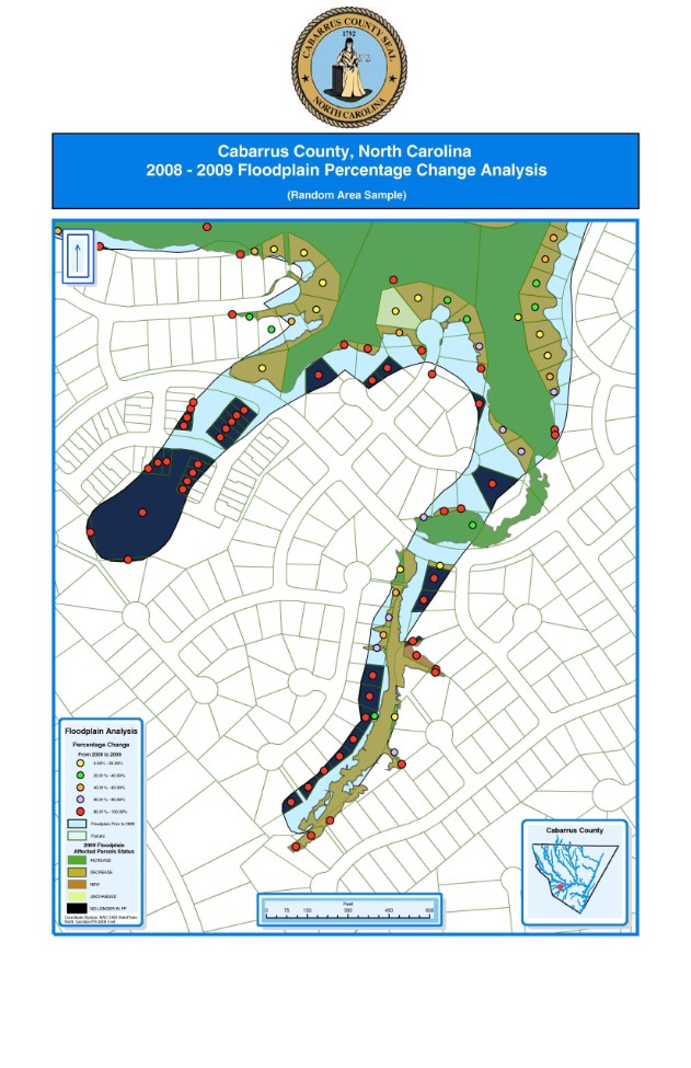
Cabarrus County NC 2009 Floodplain Map .pdf
Size : 0.422 Kb
Type : pdf

       The above map illustrates an acreage percentage change in Cabarrus County, NC floodplain affected parcels

The map above indicates Land Use for the City of Gloucester, Ma. 

           The above map illustrates a hypothetical Solid Waste Site Selection for North Mecklenburg County, NC.
                  The site was based on distances from residential homes, rivers/streams, and water bodies.

The map above is a large scale view of the Solid Waste site selection area. 

TeenPregnancy_and_ChildrenAwaitingAdoption.pdf 
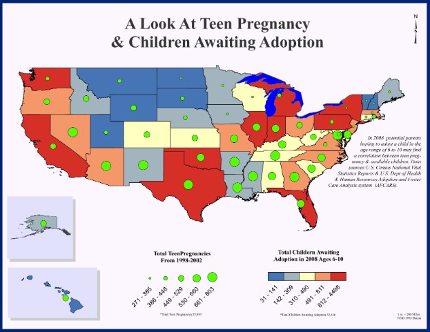
TeenPregnancy_and_ChildrenAwaitingAdoption.pdf
Size : 1081.598 Kb
Type : pdf

 The map above is comparing Teen Pregnancies from 1998-2002 and Available Children for Adoption in 2008

 within the ages of 6 - 10 yrs.

          The map above required complete annotation, labeling, and symbolization.

Make a Free Website with Yola.